SDSU Researchers Innovate Tsunami Modeling Tool To Enhance Warning Systems
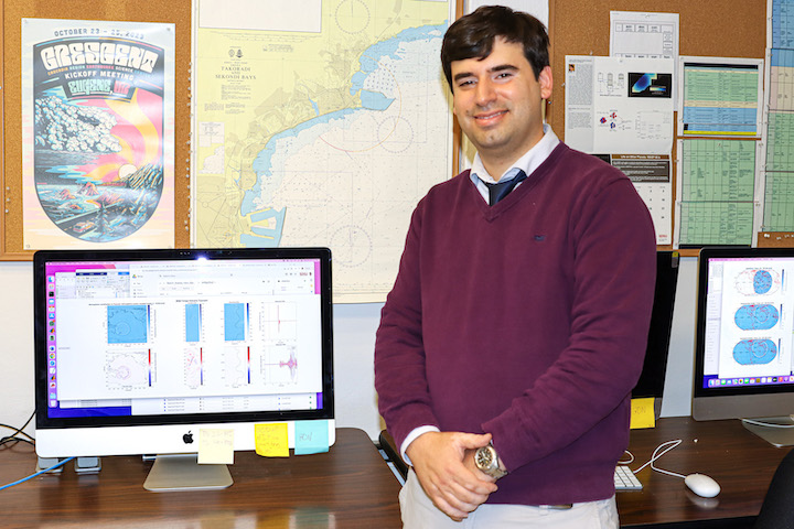
Ignacio Sepúlveda Oyarzun, assistant professor at San Diego State University’s College of Engineering, and his team invented a dynamic tsunami modeling system that will enable researchers to significantly advance warning methods to save lives and mitigate the cost of damage in oceanfront areas.
Through the creation of the new instrument, Sepúlveda found that planetary winds play a critical role in the formation of tsunamis — something that has never been proven before.
The unique approach utilizes satellite imagery and modern measurement tools, providing rich information that can be used to prevent future devastation.
His model also accounts for the elements of air temperature and topography on the behavior of atmospheric and tsunami waves, showing how it affects the speed and size of the pressure wave as it approaches features such as mountain ranges and canyons.
When a standard atmospheric and tsunami model is employed, the wave recordings are inaccurate and not recognized. The additional elements incorporated in Sepúlveda’s new three-dimensional model drastically improve the simulation of waves that affect far-reaching shores.
3D models typically require supercomputers to function, yet Sepúlveda has created it so that the models can be run on a desktop computer – significantly enhancing the accessibility and value of the early warning tool.
Originally from the coastal town of Valdivia, Chile, Sepúlveda understands the importance of early warnings of environmental hazards. The 1960 Valdivian Great Chilean Earthquake and Tsunami made history in his town as the most powerful earthquake ever recorded.
“As a Valdivian and Chilean, I grew up watching the effects of large geohazard events, including earthquakes, tsunamis, landslides and volcanic eruptions,” said Sepúlveda. “As a civil engineer, I know it is very difficult to eradicate the threats of exposed coastal communities, though it is possible to quantify the risks and manage them. I believe this is the best way to reduce life and property losses of future geohazard events. Our research aims to contribute toward that goal.”
The Investigation
Unlike those caused by earthquakes, scientists have only recently come to understand the impact of atmospheric-induced tsunamis, also known as meteotsunamis, caused by pressure waves that originate after powerful volcanic eruptions.
On Jan. 15, 2022, the Hunga Tonga-Hunga Ha'apai volcano erupted in the South Pacific Ocean, causing tsunami waves all over the world, including waters as far as Santa Cruz Bay, California, and the Atlantic Ocean.
Scientists were perplexed as to why their simulators of the meteotsunami waves failed to model what was recorded by satellites and global networks of barometers and tide gauges.
Many attributed their failed models to faulty measurement tools, but Sepúlveda felt there had to be more to this phenomenon, and viewed it as an opportunity to further understand their characteristics with modern tools.
Together with Duncan Agnew, professor at Scripps Institution of Oceanography at the University of California San Diego, and Matías Carvajal, associate professor at Chile’s Pontificia Universidad Católica de Valparaíso, the team began their study, improved the equation, and designed the new simulator.
“We discovered that global winds have a profound impact on the arrival time, shape, and amplitudes of atmospheric waves, which, in turn, have a profound effect on the tsunami waveforms,” Sepúlveda said.
Their findings also confirm that meteotsunamis can cross continents. With atmospheric waves, eruptions can be sourced from the Pacific Ocean and record a tsunami in the Atlantic Ocean. This concept does not hold true for tsunamis caused by earthquakes.
The most recent and comparable event to the Tonga eruption happened in Krakatoa, Indonesia in 1883, and caused maritime disruption as far away as Chile. However, scientists had no explanation for what happened due to the lack of technology at the time.
Yet in 2022, researchers were prepared with oceanic and satellite instruments to measure the effects in the atmosphere and the oceans. The new technology has allowed this significant advance in the modeling tool.
“The greater quality of our simulations — compared to more simplified models — demonstrates its potential as a prediction tool,” said Sepúlveda. “Ultimately, this model can be used for improving the accuracy of early warning systems aiming to save lives and long-term hazard assessments to make coastal communities more resilient.”